Our Services
Full-spectrum scanning capability
From heritage buildings to highway corridors, we have the equipment and expertise to capture it in 3D.
Capabilities
Core scanning technologies

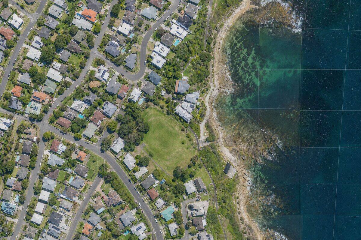
Drone 3D Mapping Brisbane
Drone surveying for sites too large, too remote, or too dangerous for ground-based scanning. Our CASA-certified pilots deploy LiDAR and camera payloads for everything from 1-hectare building sites to 100-hectare mine sites.
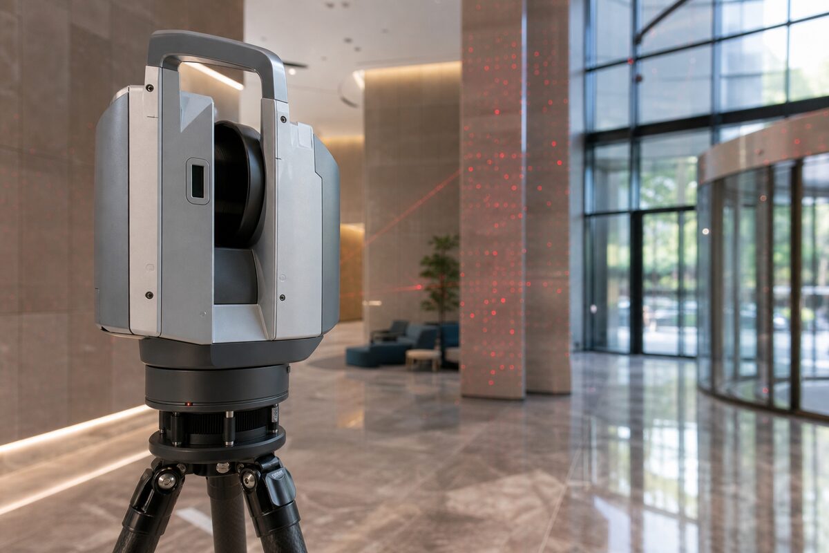
3D Laser Scanning & Point Cloud Survey
Need a building, structure, or site captured in 3D? Our laser scanning service turns physical spaces into precise digital models. We handle everything from quote through to delivery: you get clean, usable point cloud data ready for your software.
Photogrammetry Services
High-resolution aerial imagery processed into ortho-mosaics, textured 3D meshes, and surface models. Photogrammetry is the image-based alternative to LiDAR: lower cost, full colour, and ideal for visual basemaps, facade documentation, and client presentations.

Scan to BIM Modelling
Already have point cloud data? We model it into intelligent Revit or ArchiCAD BIM models at LOD 100 through LOD 400. Walls, floors, columns, MEP services, and structural steel modelled to your BIM execution plan. We accept data from any scanner.
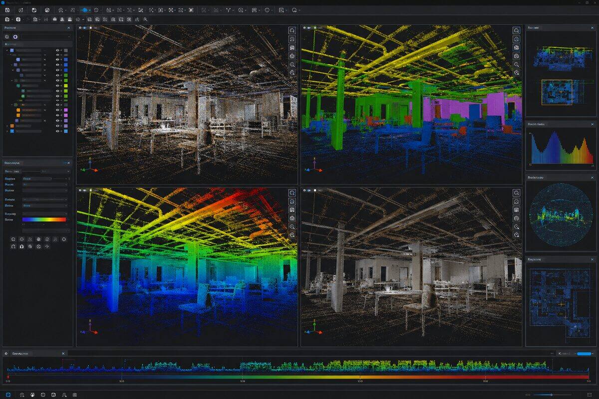
Point Cloud Processing
Point cloud processing is the set of computational operations applied to raw 3D scan data to produce clean, registered, and classified datasets ready for analysis and modelling. We handle registration, noise removal, classification, format conversion, and quality assurance.

Point Cloud to CAD
Already have a point cloud? We convert it into accurate 2D CAD drawings: plans, sections, and elevations drafted in DWG, DXF, or DGN. Point cloud to CAD is the as-built drafting workflow for teams who need clean 2D documentation rather than a 3D model. We accept scan data from any scanner.
Industry Applications
Scanning for your sector
Architectural & BIM Scanning
On-site laser scanning for architects, interior designers, and renovation contractors. We capture the full geometry of your building so you can design from accurate existing conditions instead of unreliable legacy drawings.
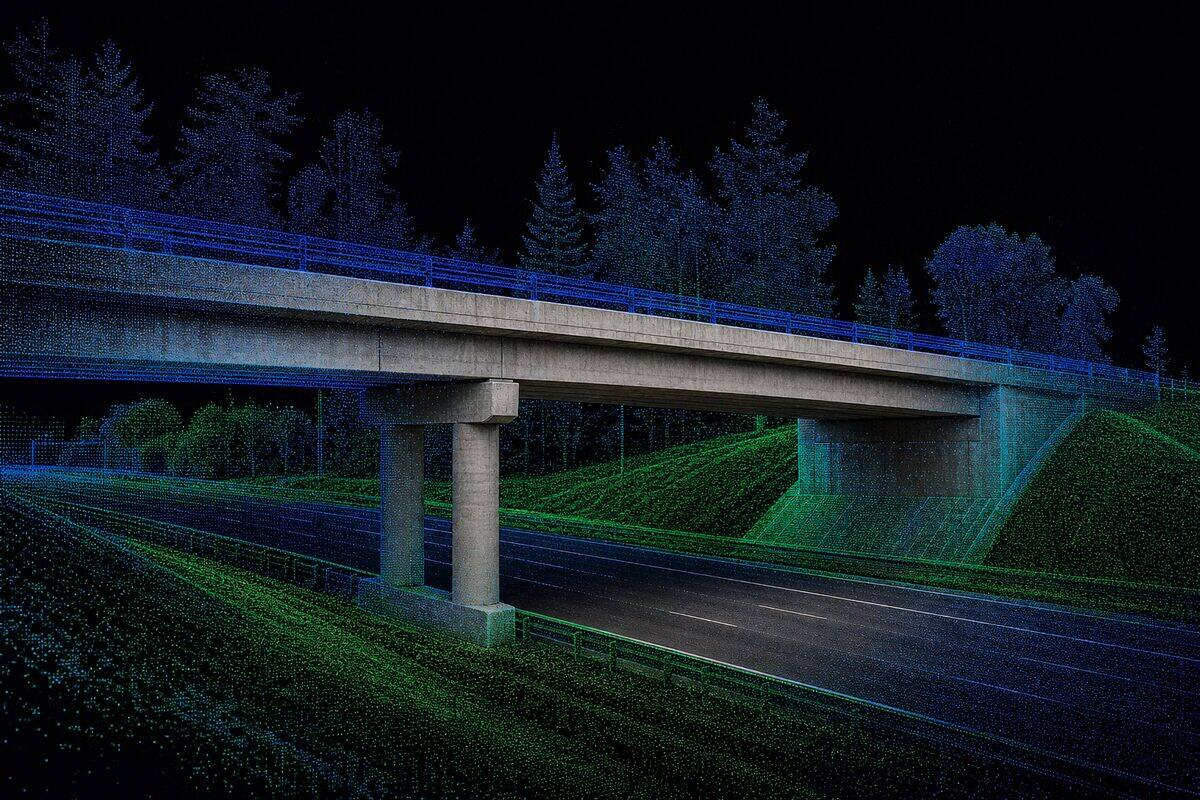
Civil & Infrastructure
LiDAR surveys for roads, bridges, rail corridors, and civil earthworks. From design verification to as-built documentation, we capture infrastructure at any scale.
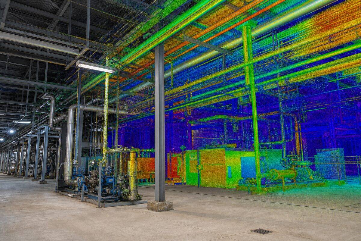
Industrial & As-Built
Comprehensive as-built documentation for factories, processing plants, warehouses, and mechanical installations. Capture every pipe, duct, and structural member in 3D.
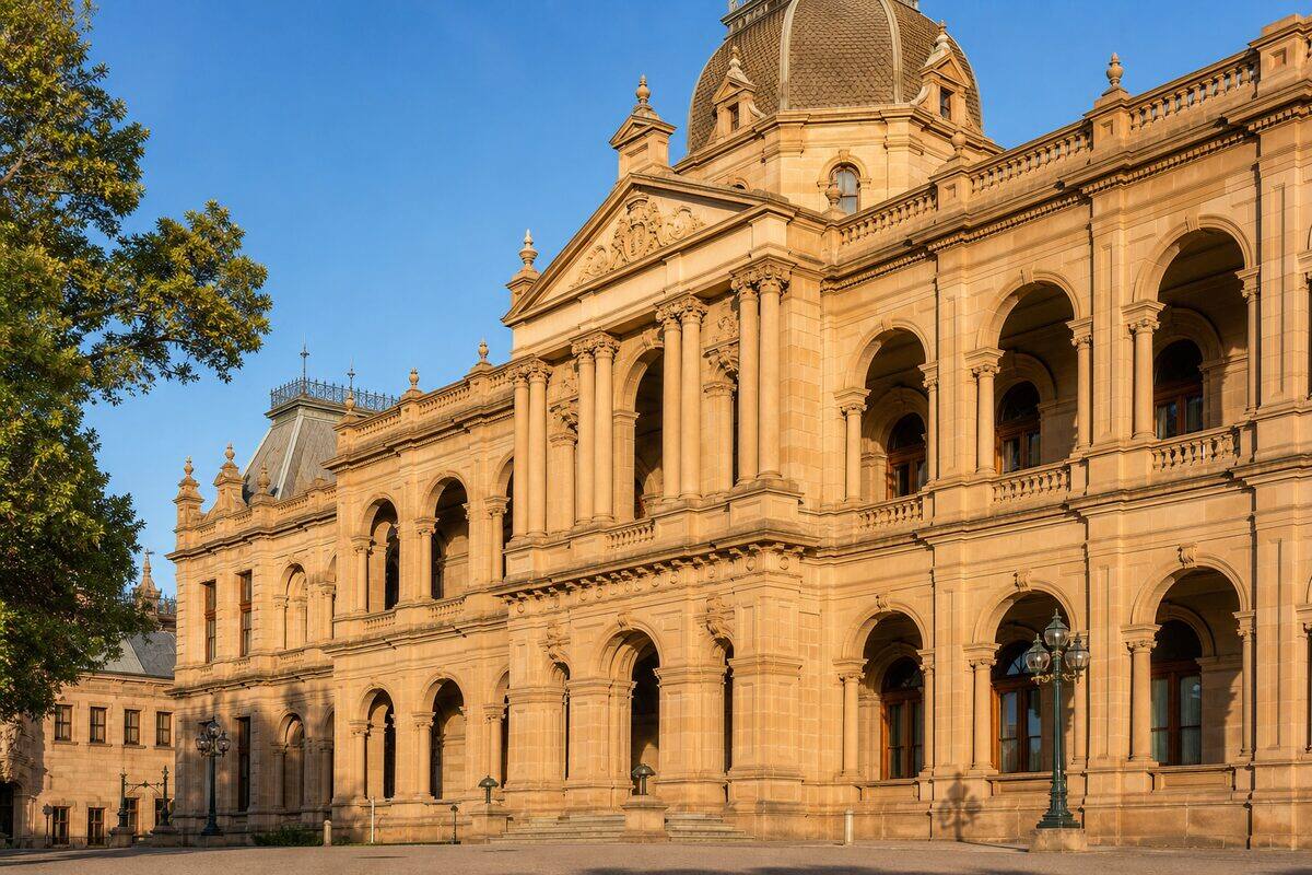
Heritage Documentation Scanning
Heritage documentation scanning is the application of 3D laser scanning to record historic buildings, monuments, and culturally important structures with archival-grade accuracy. We produce measured drawings, 3D models, and condition assessments that support conservation, adaptive reuse, and heritage compliance.
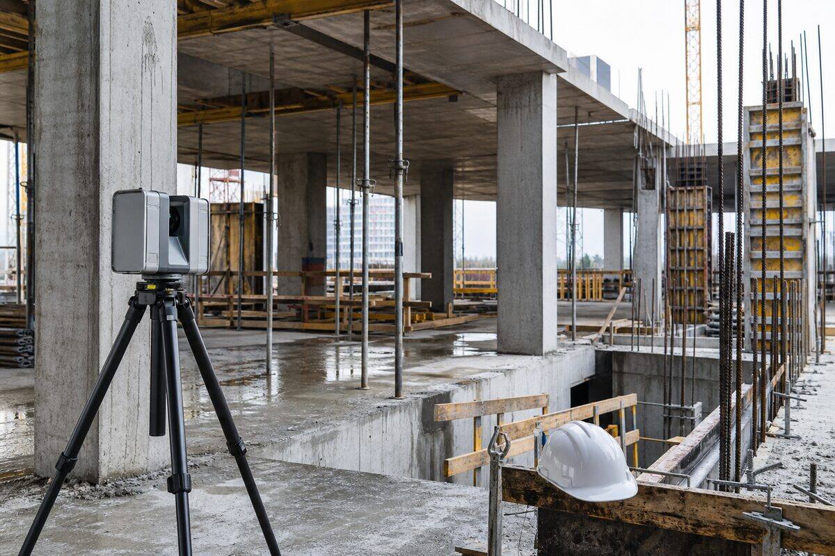
Construction Verification Scanning
Construction verification scanning is the use of 3D laser scanning to compare as-built construction against design models, detecting deviations, verifying setout accuracy, and documenting progress at each construction stage.
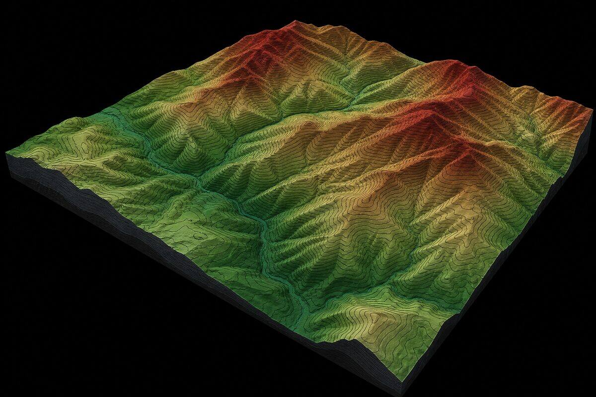
Topographic Survey Brisbane
Terrain models, contour plans, and earthworks volumes delivered from airborne LiDAR. We survey land at 50x the detail of traditional total station methods, penetrate vegetation canopy to map ground level, and produce contours at intervals as fine as 0.25m.
Not sure which service you need?
Tell us about your project and we will recommend the right approach, equipment, and deliverables.
Get in Touch